The Ha Giang Loop is a motorcycle road trip that winds you through the most remote regions of Northern Vietnam. If you’re looking for adventure in Vietnam, then LISTEN UP because embarking on a self guided tour of the Ha Giang Loop is probably as adventurous as it gets!
The Ha Giang Loop will take you from the Ha Giang city center, across the Dong Van Karst Plateau, all the way to the Vietnam/Chinese border and back! Along the way you will travel alongside beautiful rivers, pass through lush jungles and high mountain passes, experience remote villages and SO much more!
This is just one of the adventures we experienced while we explored Southeast Asia. For MORE epic adventures and itineraries for Southeast Asia check out how we spent a month in Thailand, Vietnam, and Cambodia!
This blog has TONS of information covering everything you’ll need to know in order to self guide the Ha Giang Loop. It can be overwhelming at first, but be sure to take your time reading each section and really soaking in the information and I promise you’ll be ready to take on the Ha Giang Loop when you’re finished reading!
Contents
| ***Disclosure: This post contains affiliate links. If you click one of them, I may receive a small commission (for which I am very grateful for) at no extra cost to you. |
Where is the Ha Giang Loop Located
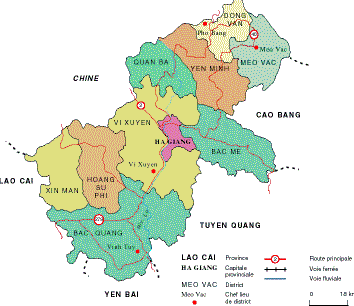
The Ha Giang Loop is located in the northern-most province of Vietnam known as Ha Giang. The capital of the Ha Giang province is a centrally located city that also goes by the name of Ha Giang. Your journey on the Ha Giang Loop will begin and end in the city of Ha Giang.
Ha Giang is highlighted in pink. The loop is the red line that flows through Quan Ba, Yen Minh, Dong Van, and Bac Me.
How to Get to Ha Giang City
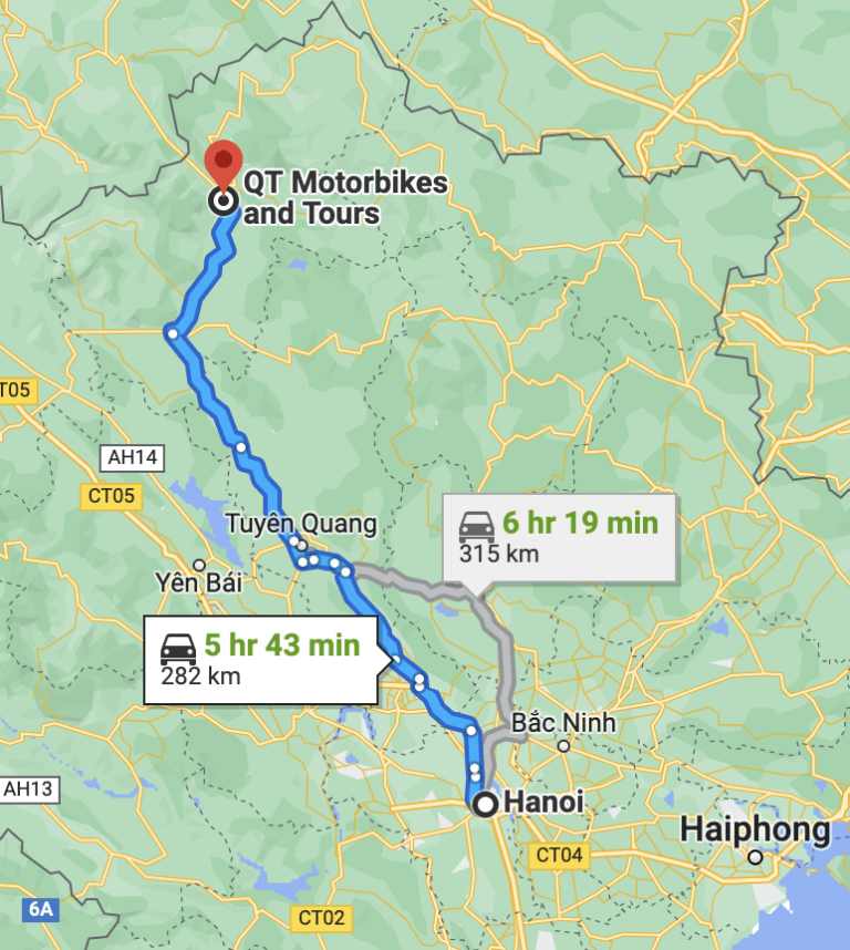
Getting to Ha Giang is a bit of an adventure on its own. You’ll need to book a bus from Hanoi to make the six-hour trip to Ha Giang. We used Baolau to book a limousine bus. This six-hour trip included one pit stop at the halfway point for restrooms and a snack. Just a fair warning, it’s a curvy drive so you may want to pack some dramamine!
Best Time to Drive the Ha Giang Loop
While you can travel the Ha Giang loop at any time of the year I’d recommend going between December-April. This is considered the dry season and you will definitely want dry conditions for the roads you’ll be travelling.
Now, having said that, the loop travels though a very mountainous area so the weather can be hard to predict at any time of the year. We did it in January and experienced rain on three of our five days. However, I believe we just had a bit of bad luck because the weather for the week before and after our trip was full sunshine. This really just means you should hope for the best, but pack for the worst!
If you’ve packed correctly then regardless of conditions the loop will still be an amazing experience.
What to Pack for the Ha Giang Loop
Speaking of packing…
The Ha Giang Loop can vary wildly with temperature fluctuations. This regions climate is different from most of Vietnam so make sure you’re checking the weather frequently for this specific location when packing.
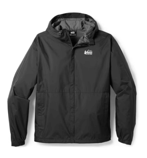
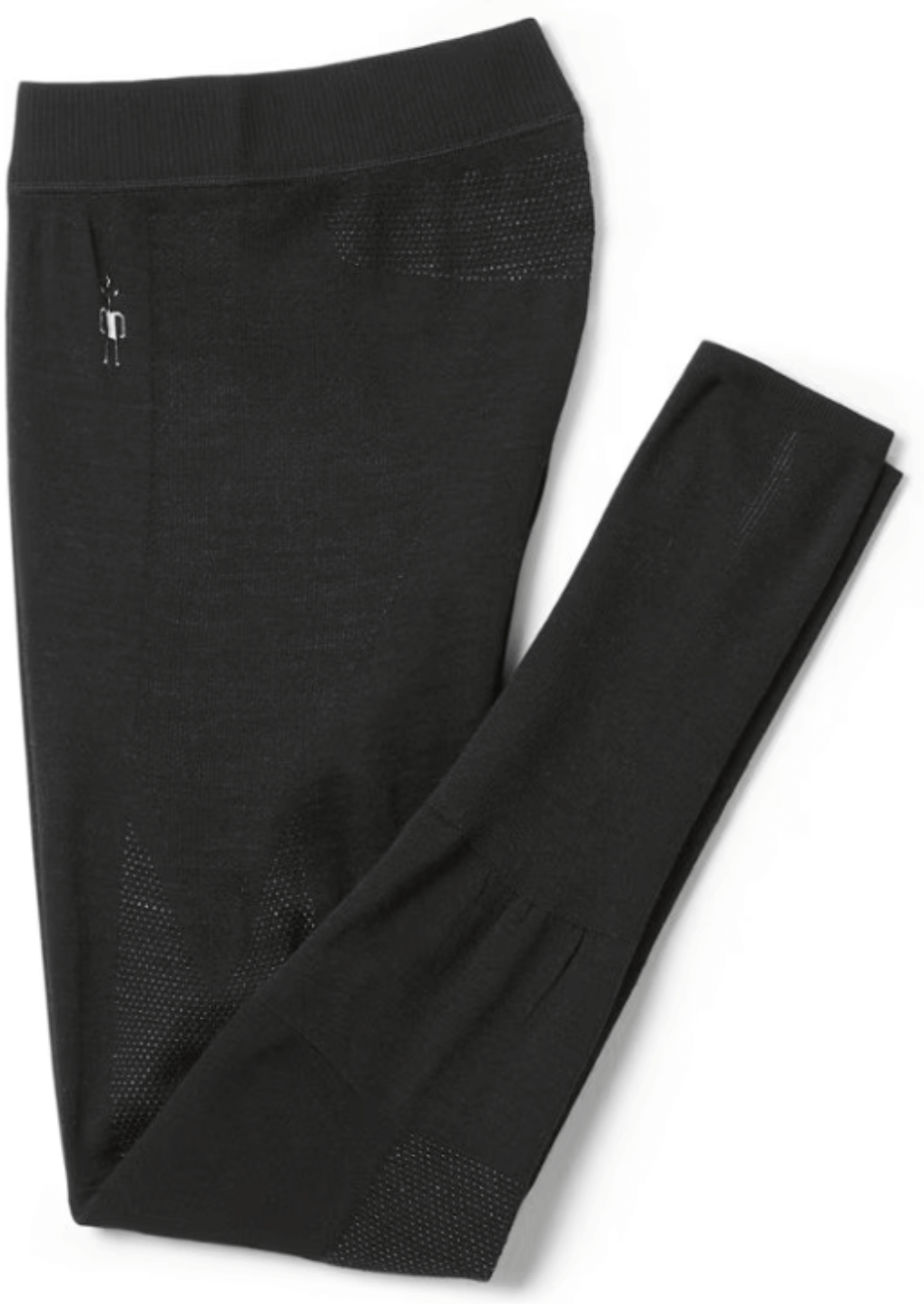
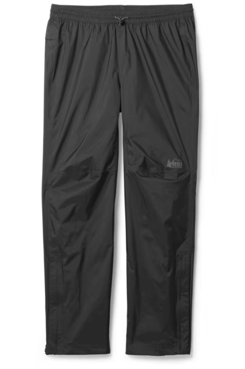
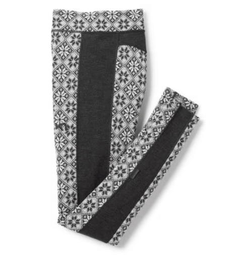
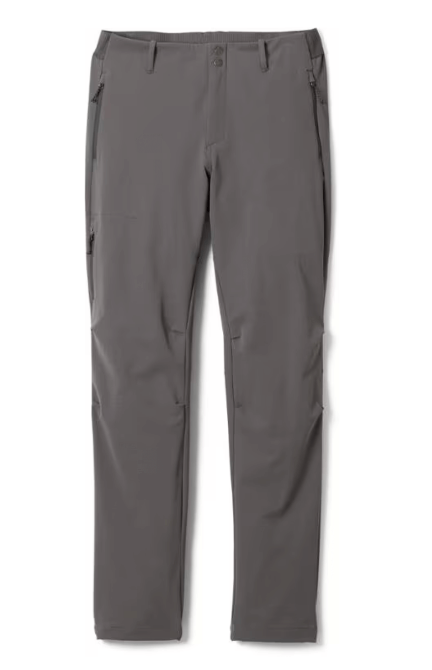
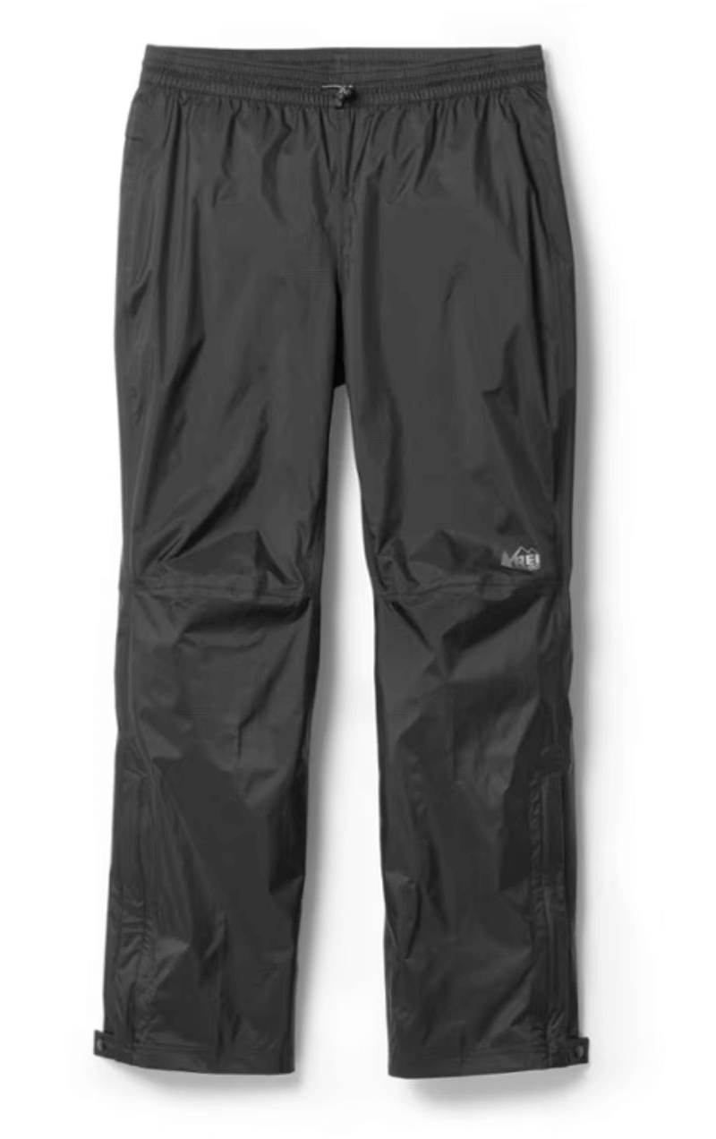
If you’re traveling in January like we were then you’ll need to pack warm clothes to layer with. Even with modest temperatures things like fog, rain and wind will make your motorcycle ride significantly colder! Regardless of the time of year you need to bring rain gear with you. This includes your hands and feet!
And remember, you’ll need to be able to strap your luggage on your motorcycle so make sure that your bag stays small. My wife and I took two backpacks; here’s what we packed:
How Many Days to Complete the Ha Giang Loop
This is a personal choice. You could honestly spend a full month on the Ha Giang loop and never run out of unique adventures to experience. The region is still somewhat un-explored and overflowing with new adventures awaiting discovery.
But from a practical perspective the journey can reasonably last anywhere from three to five days. The route is roughly 240 miles (386km) total. So, an even split of the distance would look like this…
3 days: 80miles/day (129 km/day)
4 days: 60 miles/day (97 km/day)
5 Days: 48 miles day (77 km/day)
Remember, the trip consists of mostly VERY curvy mountain roads and these miles pass much slower than highway miles. Plus, there’s an endless number of scenic viewpoints and side excursions so you’re going to want some extra time to explore these locations. We set aside five days to complete our trip and felt like we had just enough time to experience everything we wanted out of the loop. Here’s a short breakdown of our planned route:
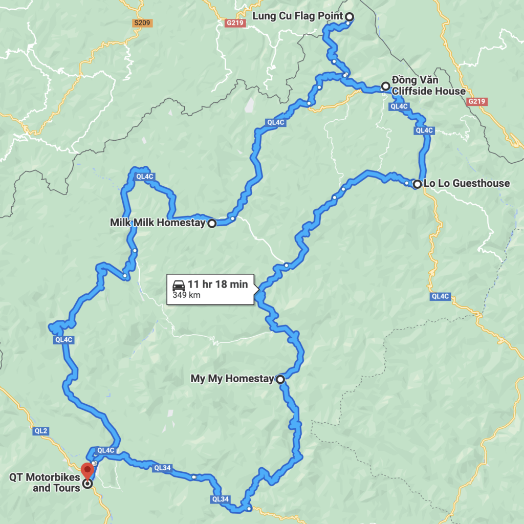
Day 1: Ha Giang – Yen Minh = 63miles (101km)
Accommodation: Milk Milk Homestay
Day 2: Yen Minh – Lung Cu – Dong Van= 47miles (75km)
Accommodation: Dong Van Cliff Side House
Day 3: Dong Van – Meo Vac = 20miles (31km)
Accommodation: I’ll explain later
Day 4: Meo Vac – Du Gia = 50 miles (81km)
Accommodation: My My Homestay (cannot book online)
Day 5: Du Gia – Ha Giang = 61 miles (98km)
Accommodation: Bus back to Hanoi
Total= 240miles (386km)
How to Travel the Ha Giang Loop
You can travel the Ha Giang loop guided or self-guided. If you’re not into researching, then I would recommend going on a guided tour because the locals will know the best stops to make. However, you’ll be at the mercy of the group, so you won’t have the freedom to explore anything outside of their scheduled itinerary.
My guess is that if you’re reading this you want to complete the loop self-guided. That’s what we did and it’s what I would recommend to anyone who is comfortable driving a motorbike! You’ll have the freedom to explore at your own pace and the entire trip will feel much more adventurous!
You have the option to complete the loop in a bus, on the back of a motorcycle, or driving your own motorcycle. If you’re not prone to car sickness then the bus might be a good option, but after seeing the buses on the route it’s very hard for me to recommend this option. The roads are curvy and the drivers are in a hurry.
The guided tours offer the option to ride on the back of a motorcycle while your guide drives. This is good option if you’re not confident enough to drive yourself or if you just want to enjoy the view.
The last and most common option for most is to rent their own motorcycle. This is what we did, and we loved every second of it.
How Much Experience Do You Need?
I wouldn’t say you need a TON of experience driving a motorcycle prior to driving the Ha Giang loop; however, I wouldn’t recommend LEARNING how to ride here. The roads are narrow, curvy, and quite exposed in some sections so a mistake could be detrimental, and you’ll be a long ways from help. Add a rainy day to this mix and a new rider could get overwhelmed. But anyone with a little experience on a bike will fair just fine on the Ha Giang Loop!
What Kind of Bike to Rent
You can rent a variety of motorcycles for this trip. You can choose between fully automatic, semi-automatic, and manual.
Fully Automatic Bike
A fully automatic bike means that the bike will change gears for you. I don’t recommend this option because of the steep winding roads along the route. The bike will struggle with the elevation change and it won’t be an enjoyable ride.
Semi-Automatic Bike
Semi-Automatic bikes allow you to manually change gears without using a hand operated clutch. This is a much better option for the route and is what I would recommend for a less experienced rider. You’ll be able to focus on the road ahead and not have to think too much about operating the bike.
Manual Motorcycle
Manual motorcycles require the use a hand operated clutch to change gears. This is the same concept as driving a stick shift vehicle, but the hand and foot functions are reversed. If you’re comfortable with operating a manual motorcycle, then this is what I recommend. You’ll have full control over the bike, plus it adds a little more spice to the ride! This is the option we chose.
The Route
You’ve endured the six-hour ride from Hanoi, you’ve just rented your motorcycle and now it’s time to hit the open road. But where should you stop? Honestly, this part can be overwhelming because there’s so much to see. Below, I’ll give you a detailed description of the route we took, the stops we made, the stops we missed, and our accommodations each night, BUT my recommendation would be to just hit the road without a hard plan! Definitely know your options, but make each decision in the moment!
Hanoi to Ha Giang-> The Night Before the Ha Giang Loop
We booked a limousine bus from Hanoi to Ha Giang using Balou the night before our trip began. We rented our bike from QT Motorbikes and luckily, they have a small guesthouse where you can stay on site!
Day 1: Ha Giang -> Yen Minh via QL4C
Distance: 69 miles (111km)
Accommodation: Milk Milk Homestay
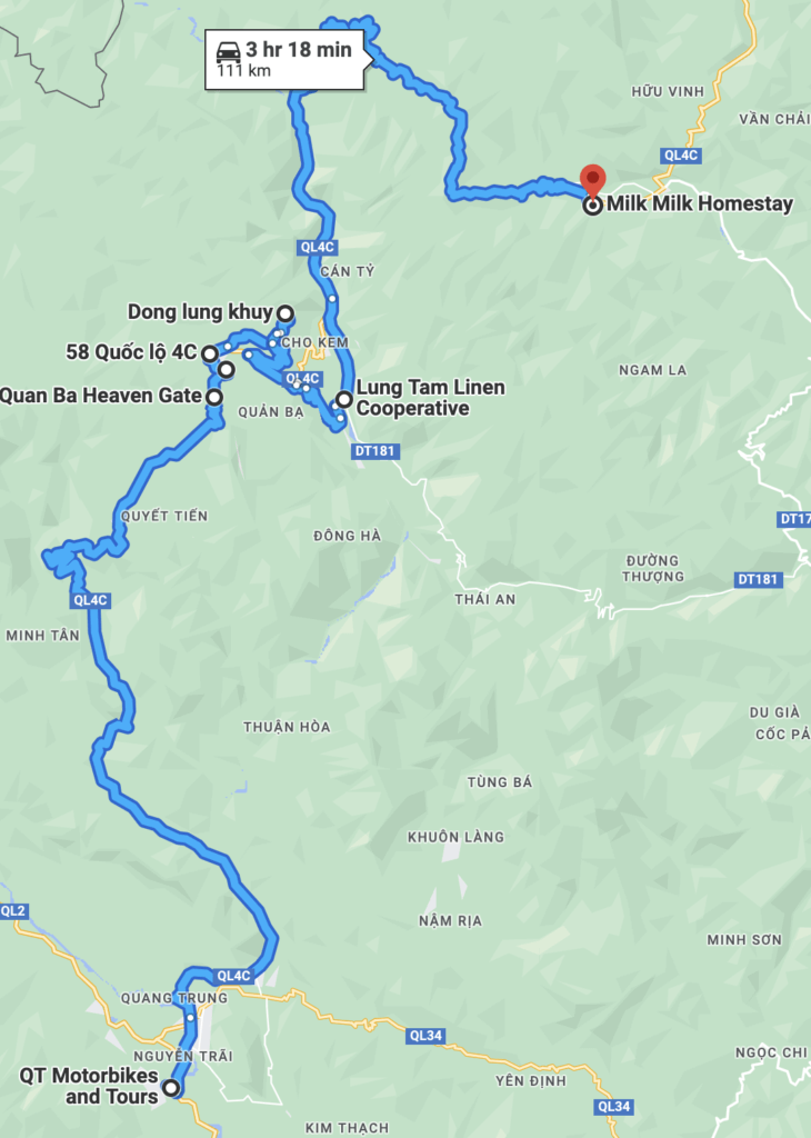
We woke up, strapped on our packs and took off on the journey of a lifetime. We made it just outside the city when the bike began to sputter and shortly after came to halt. I had wrongly assumed the bike would have a full tank from the rental shop and we were now stranded. Somehow, we were just a mile from the nearest gas station, so the push back wasn’t too bad. I can’t describe how lucky we were here; most of the ride is very remote and gas stations are seldom. So let my mistake be your reminder to check your gas tank!
Soon we were on the road again and it didn’t take long for the incredible views to start!
Day 1 Ha Giang Loop Highlights:
Heaven's Gate (Quan Ba Pass)
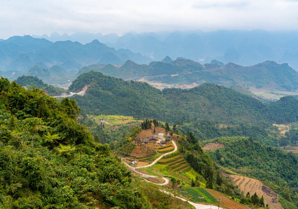
Heaven’s Gate is a scenic mountain pass and will be the first established stop on your journey. The ride to and beyond the pass are VERY curvy and exciting! Once at the summit you can stop at Café Cong Troi for coffee and a snack. This café was closed when we were here, but the view was still incredible. Across the street there’s a short hike up a rock staircase that leads to a less crowded viewpoint. It only takes a couple minutes of your time and provides 360 deg views of the surrounding mountains!
Twin Fairy Hills
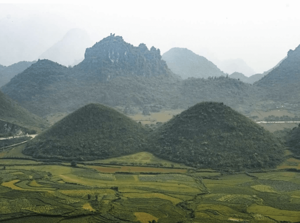
After crossing the pass be on the lookout for the Twin Fairy Hills. There isn’t a designated pull out for this stop so just look for a safe place to pull over on the side of the road. The view is beautiful, and the Fairy Hills are interesting but overall, this is a quick stop.
City of Tam Son
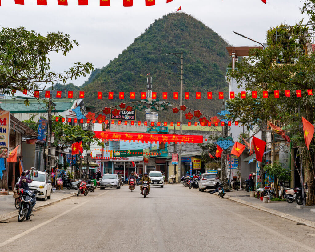
Lung Khuy Cave
This is an incredible cave located just 15 minutes outside of Tam Son. We skipped out on this one because we had visited a cave in Thailand just a few days prior to this trip, but if you haven’t seen a cave in Southeast Asia yet then I highly recommend this stop! You can learn more about the cave here.
Lung Tam Village
Yet another great stop just 24 minutes outside of Tam Son. At the Lung Tam Linen Cooperative you can see local women masterfully operating looms to weave beautiful linen pieces. This is a great place to pick up a unique souvenir, and it also helps support the local community.
Song Mein River
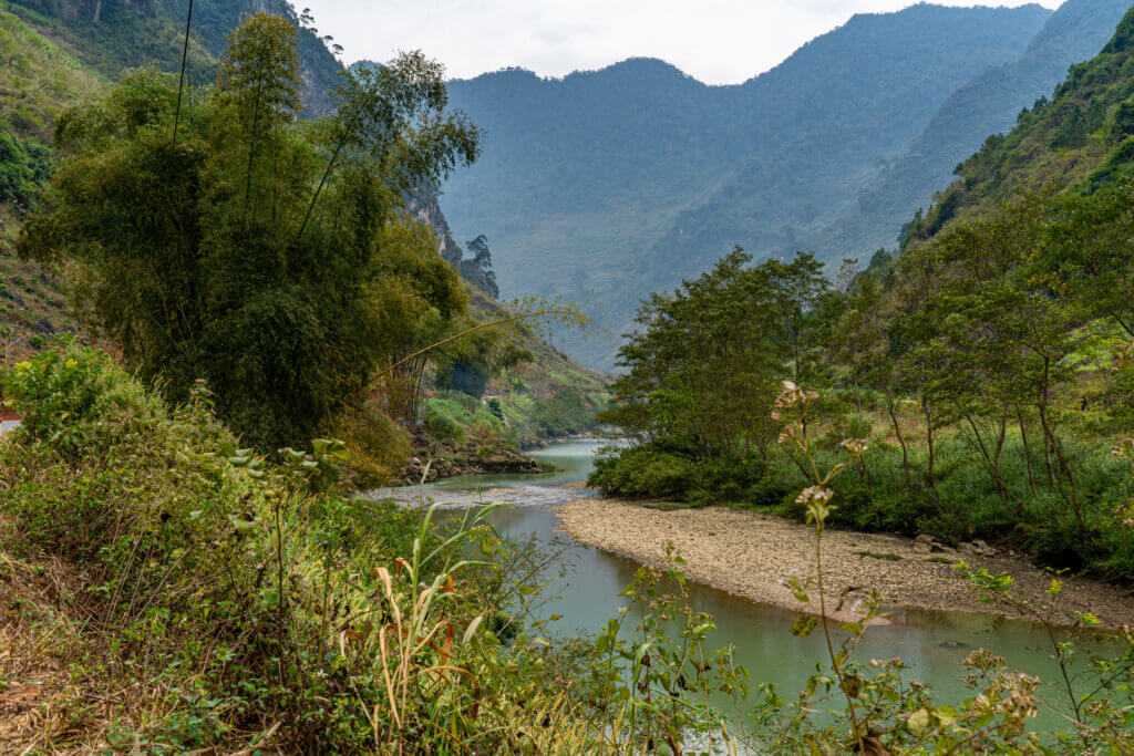
Song Main River sits in a beautiful valley that houses a short stretch of the Song Lo River. There’s no “must do” stops here, but the scenery it top notch!
Now continue your ride to Yen Minh. We arrived later in the day and went straight to the Milk Milk Homestay. We opted for the family dinner at Milk Milk and met some amazing people from every corner of the globe and shared the “Happy Water” with them. This was my second favorite stay of the trip!
Day 2: Yen Minh -> Lung Cu -> Dong Van
Distance: 47 miles (75km)
Accommodation: Cliff Side House
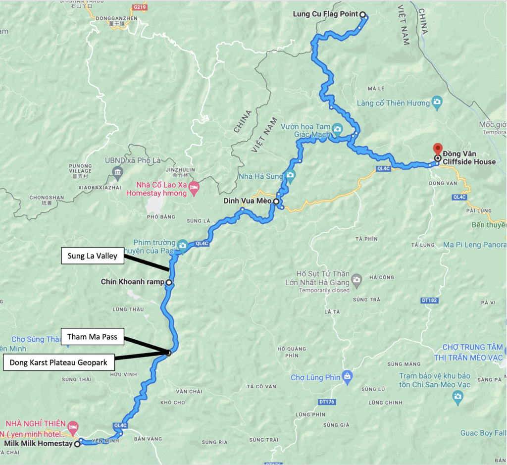
Day two is when the weather turned for us. Most of the ride was cloaked with a heavy fog that turned to rain when going over mountain passes. The temps dipped to 40 *F (4 *C) and when combined with the intermittent rain it made for an unpleasant ride. However, this day is still slammed full of things to see so don’t let the weather discourage you! And remember to top off your gas tank before leaving town.
Day 2 Ha Giang Loop Highlights:
Dong Van Karst Plateau
This isn’t a stop; this is the beginning of the Journey. For the remainder of the loop, you will be traveling through the UNESCO World Heritage Site known as the Dong Van Karst Plateau. The geopark is home to seventeen different ethnic groups. You’ll see these different groups along your journey. Just be on the lookout for brightly colored traditional dress. It will be obvious once you’re there.
It’s also home to a variety of unique animals such as the southern serow mountain goats, Asian Black Bears, and the highly endangered Tonkin Snub-Nosed Monkey. This monkey is only found in the Ha Giang region of Vietnam so be on the lookout for this rare primate!
Tham Ma Pass
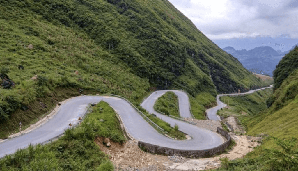
Tham Ma Pass is another scenic mountain pass and is also home to one this most famous road pictures on the Hi Giang. It’s worth stopping here for your own picture if the weather is good. It’s common to see H’mong children here in traditional dress and carrying flowers requesting pictures. You’re expected to pay for pictures with them and this is an ethical dilemma to say the least. I’ll let you make your own judgement call here.
Chin Khonah Pass
The next viewpoint on your trip will come at Chin Khoanh Pass. This was my favorite pass to drive because it winds for miles and the views are incredible. There are many options to stop and enjoy the view here.
Sung La Valley
As you’re descending Chin Koanh Pass the Sing La Valley will come into view. This picturesque valley is known mostly for its beautiful flowers that bloom in the springtime. It’s also home to the House of Pao. This house is only famous due to it being featured in a popular Vietnamese Film called Pao’s Story. This stop provides a good look at what traditional Hmong homes look like.
The "Opium Palace" (Dinh Vua Meo on Google Maps)
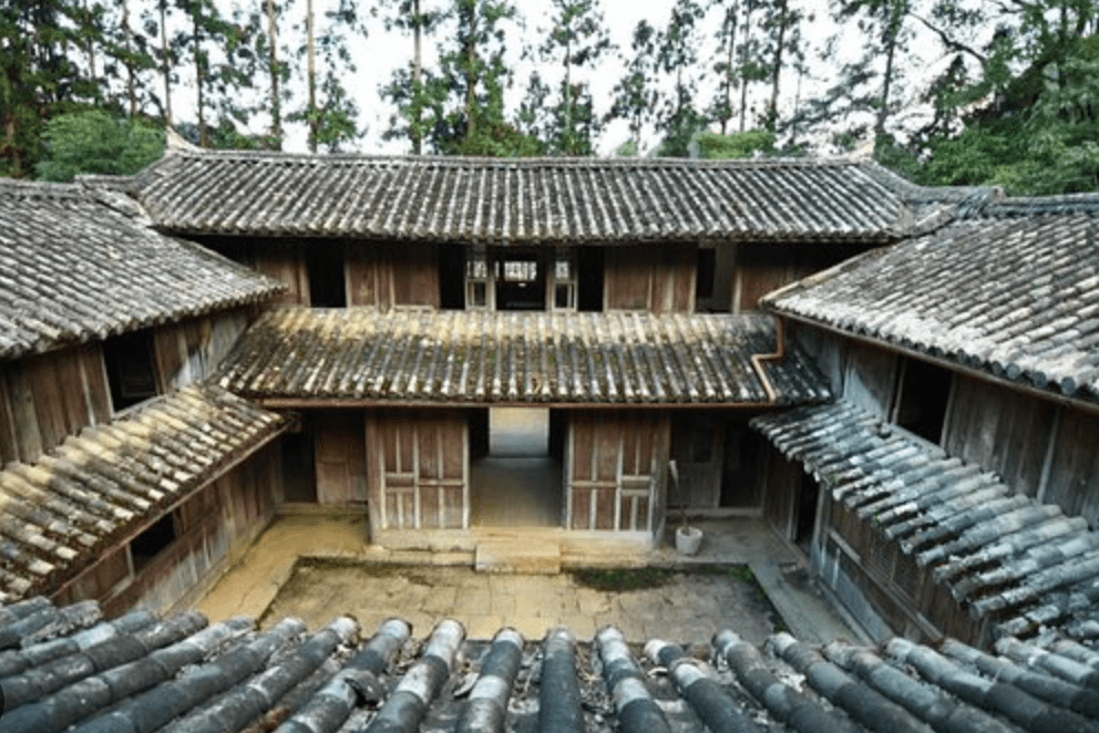
This is the home of Vuong family. This was a very wealthy and influential family in the Ha Giang region. A large majority of their wealth came from land ownership, growing poppies, and exporting opium.
Lung Cu Flagpole
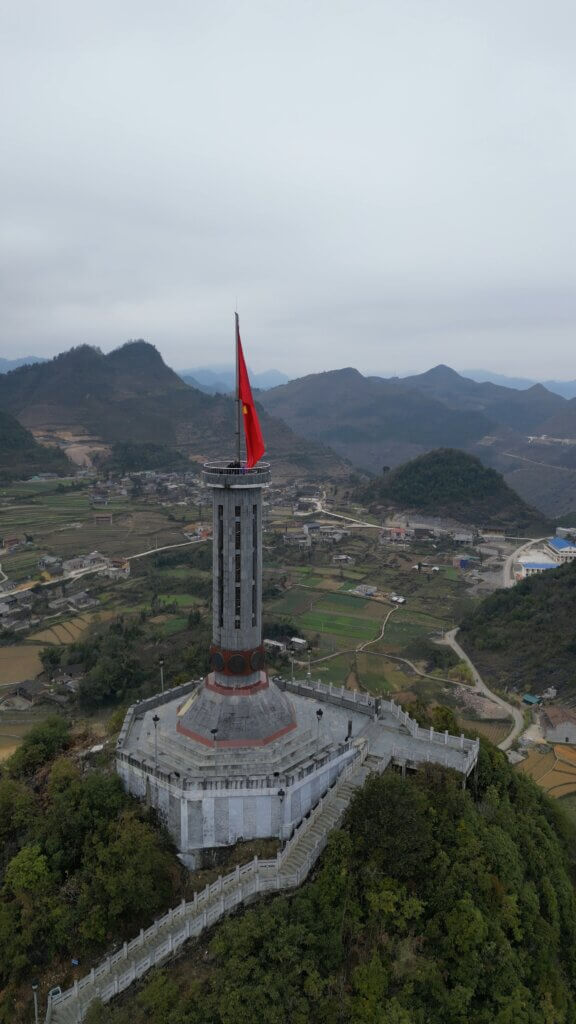
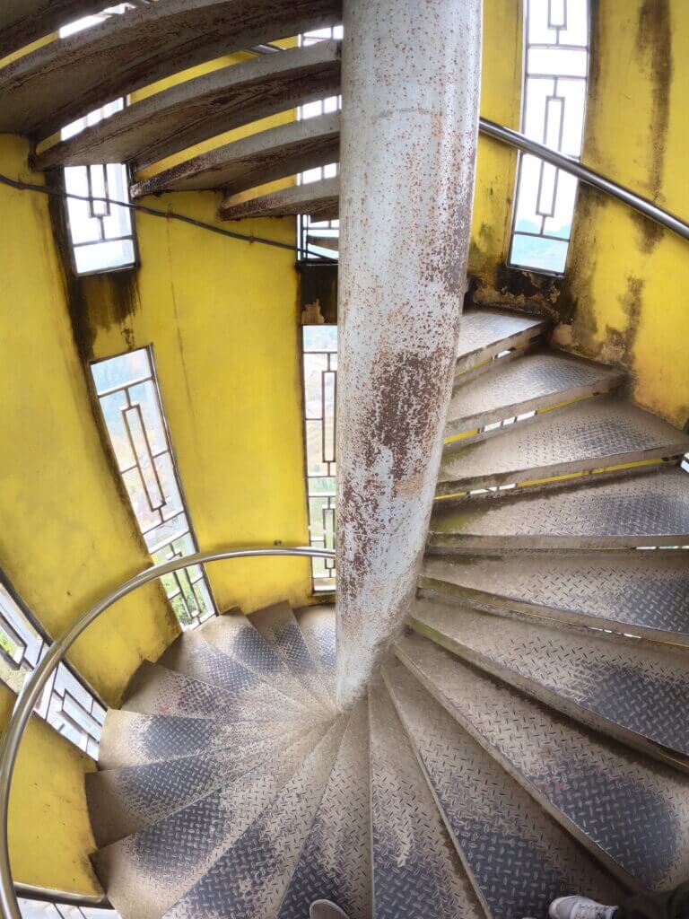
The Lung Cu Flagpole marks the northern most point in Vietnam. Pay a small fee and climb to the top of the flagpole for panoramic views of the Vietnam/Chinese border and the surrounding landscape. This stop is out of the way, but a must see in my opinion.
After the Lung Cu Flagpole make your way to Dong Van. This is the biggest city along the route, and there’s a variety of things to do in the surrounding area.
Day 3: Dong Van
Distance: 0 miles
Accommodation: Cliff Side House
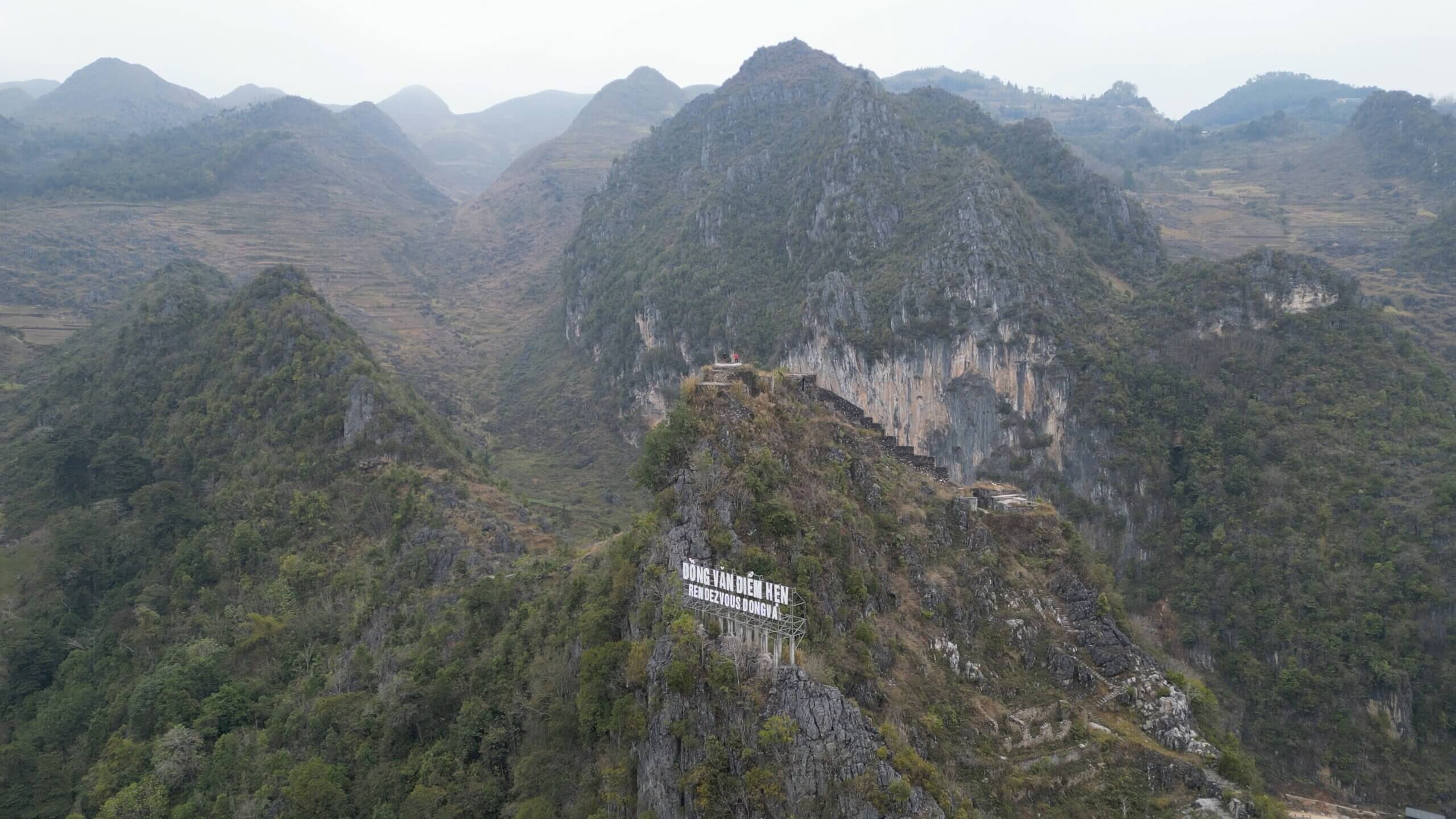
After a long day in cold rainy conditions, we were beat. On day 3 our plan was to drive to Meo Vac, but since the weather was still crummy, so we opted to spend an extra day in Dong Van.
Day 3 Ha Giang Loop Highlights:
Don Cao French Fortress
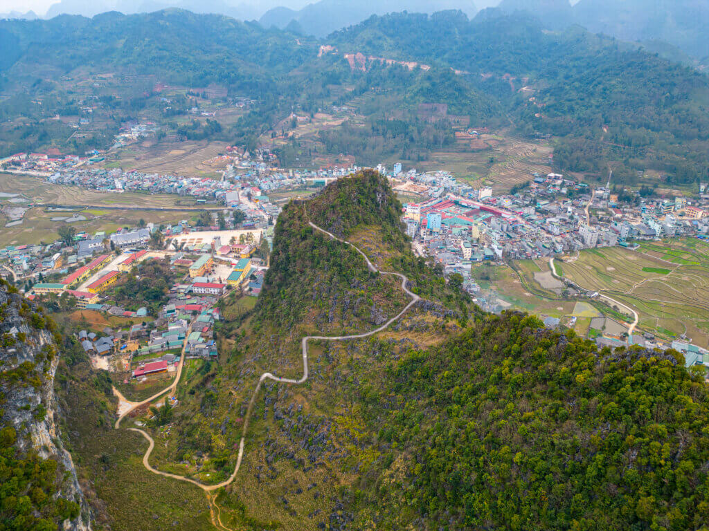
If you stay at Cliff Side House, then this historical site will be right outside your door. This fort was built by the French in 1925 during Frances’s occupation of the Hi Giang region. It’s quite a steep hike to reach the top, but the views are worth it. I saw a few locals ride their scooters up to the entry stairs and did it once myself. I highly discourage this unless you are VERY comfortable on a motorcycle. The path is narrow, very steep, and exposed. A slip up on the way up or down would have serious consequences. Seriously, don’t recommend doing this!
Dong Van Old Quarter
The Dong Van Old Quarter is comprised of about 40 homes ranging from 100-200 years old. This area has a variety of restaurants and shops designed mostly for travelers passing through.
Dong Van Market
If you are in Dong Van on a Sunday, then you’re in luck. The Dong Van market is one of the largest markets in the region. It attracts all the local ethnic minorities and is a great place to try local cuisine and pick up souvenirs.
Day 4: Dong Van -> Meo Vac -> Du Gia
Distance: 70 miles (112km)
Accommodation: My My Homestay
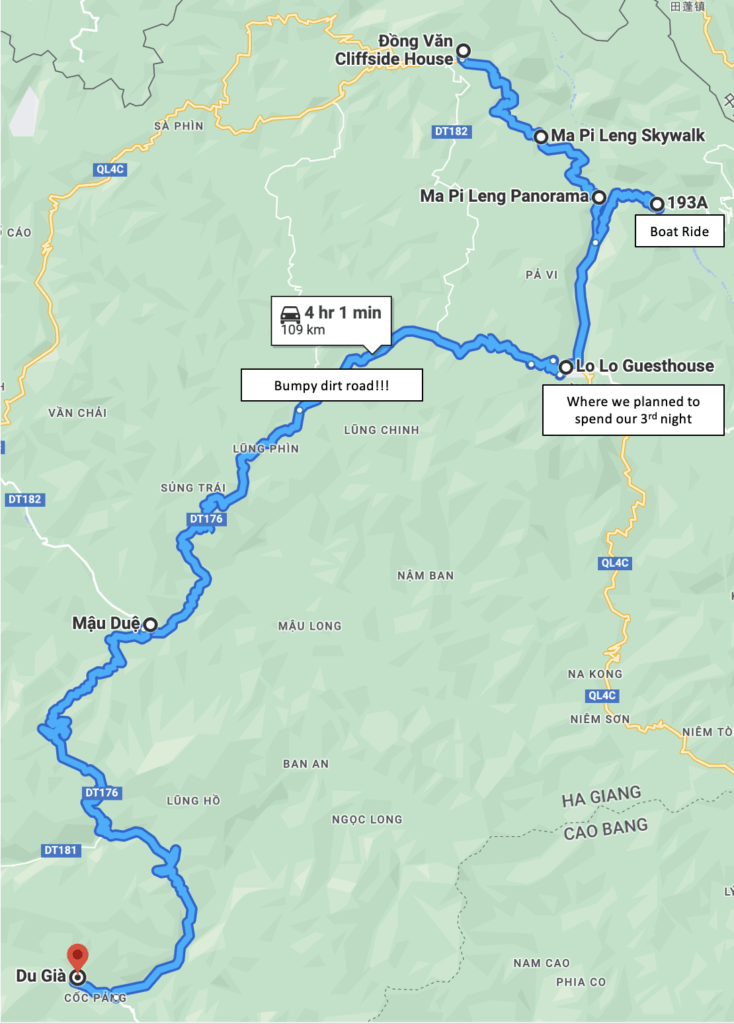
This day is the highlight of the trip for most people. Your drive the famed Ma Pi Leng Pass and travel over 30km on an “off-road” path to make it to your final destination. This was by far my favorite day of the trip.
Day 4 Ha Giang Loop Highlights:
The Skywalk
The skywalk is an exposed 1.9 mile trail that offers incredible views of the Nho Que River. Don’t miss out on this one!
Ma Pi Leng Pass (The Happiness Road)
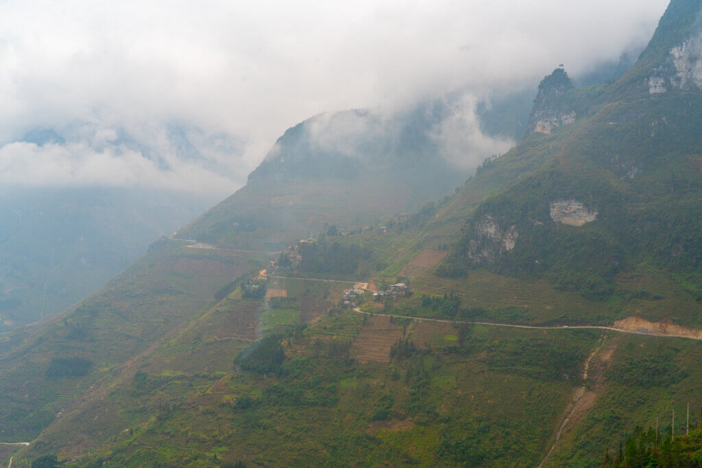
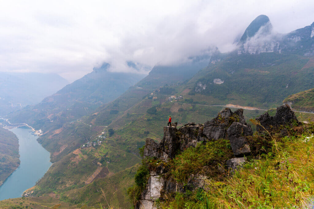
For most people this stretch of road will be the highlight of the trip. The road is hanging on the mountainside and parallels the Nho Que river for miles. There’s an endless amount of possible stops in this section and I recommend taking them all. This area is truly incredible.
Tu San Canyon
The Tu San Canyon is the deepest canyon in Vietnam and believed to be the deepest canyon in all of Southeast Asia at a depth of 2,640’ (800m). This canyon will be obvious as you drive Ma Pi Leng pass, but make sure you stop at the panoramic viewpoint to get an epic view of a bend the in the river that looks straight down the canyon! This canyon is also supposed to be home to some of the rare Tonkin Snub Nose Monkeys mentioned earlier. Make sure to keep an eye for them on your next stop.
Boat Ride on the Nho Que River
Just before you reach Meo Vac you can turn down road 193A to reach the bottom of the canyon. This is a very curvy road that will take you to the Nho Que River. Once you reach the river turn right and head towards an area with a small market, buses, and a ticket stand. Here you can buy a bus ticket and boat ticket for a 1 hour ride down the river. Do not attempt to drive directly to the boat dock. The dock is located behind a hydroelectric plant and you need to be shuttled through the property.
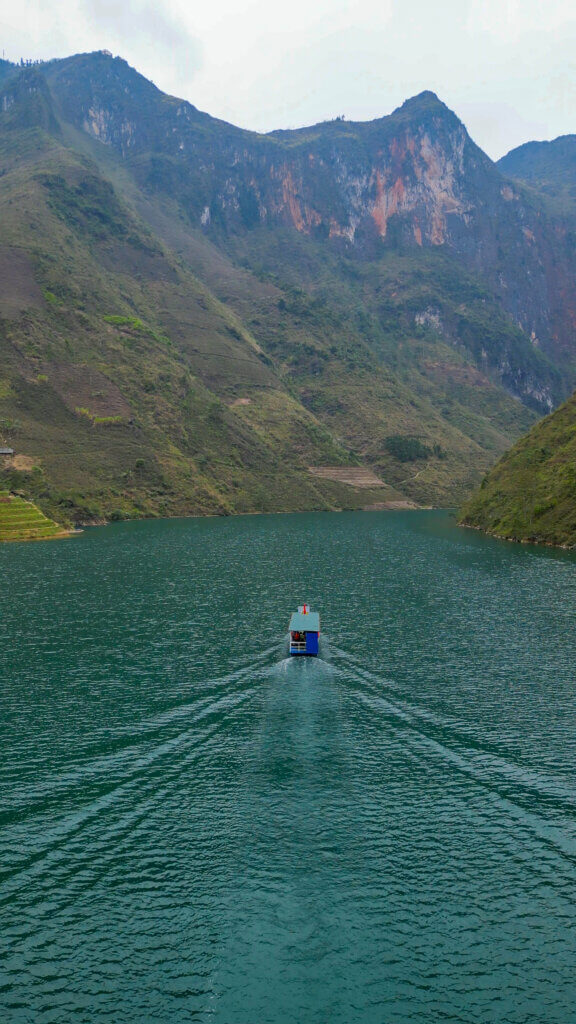
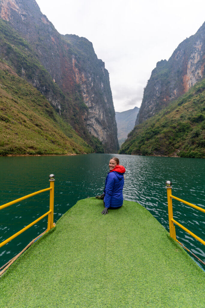
There’re mixed reviews on this boat ride. Some boats are jammed packed. Some of the guides blast music during the ride. And then sometimes you get lucky like us and have a quiet ride with the boat to yourself. Overall, I think this is experience is worth it and I would do it again if given the opportunity. The boat took us through Tu San Canyon and stopped at what seemed to be a mock traditional village for pictures.
Meo Vac
This city has a lot to offer but due to our time constraints we decided to head directly for Du Gia. I recommend checking out this blog for more information about Meo Vac.
Meo Vac to Mau Due
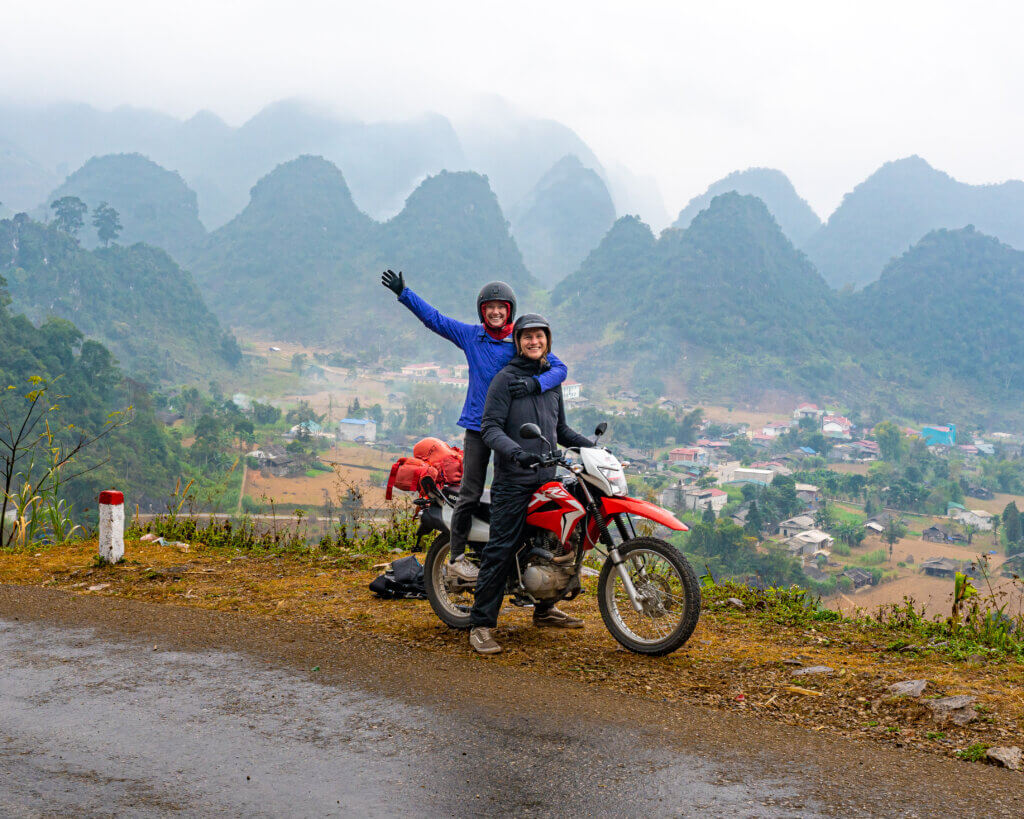
Be prepared for a bumpy ride. You’ll branch off of QL4C and take DT182 out of Meo Vac and later turn onto DT176. You’ll quickly be on a dirt road and traveling through some very remote sections of Vietnam. The dirt section lasted all the way to Mau Due, and provides some extra spice to the days drive. The town of Mau Due is quiet small, but the surrounding mountains are beautiful! Make sure to stop for a picture on the drive out.
Finally, arrive in Du Gia and get settled into My My Homestay for the night.
Day 5: Du Gia -> Hi Giang
Distance: 61 miles (98km)
Accommodation: Bus back to Hanoi
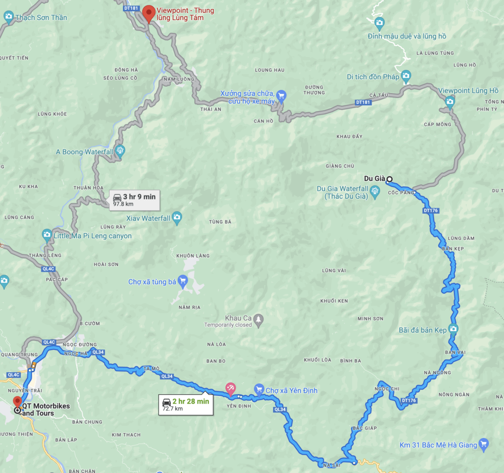
On the final day we had a slow morning at My My Homestay. We drove around town and eventually made our way to the Du Gia waterfall. If it’s warm when you’re here then this is the perfect swimming hole, but if it’s cold it’s worth the hike just for the view!
The drive back to Hi Giang is scenic, but nothing special in comparison to what you just experienced. Once back, return your bike and make your way to the bus stop for your ride back to Hanoi!
Helpful Links
Here are a few helpful links that we used to plan our own Self Guided Ha Giang Loop Tour! Please leave a comment if you have any questions or need something clarified! We want everyone to enjoy this incredible journey as much as we did!










2 thoughts on “The Ha Giang Loop Ultimate Travel Guide!”
Pretty! This was an extremely wonderful post. Thank you for providing this info.
Pingback: Endless Discovery Awaits on the Astonishing Road - modapls.com